Bhutan, Land of the Thunder Dragon
 |
| Thimphu Tshechu |
An enchanting country, one where TV was only introduced in 1999, where there are no traffic lights anywhere, a nation which measures its own success in terms of 'Gross National Happiness', and where the national dress is proudly worn almost everywhere.
It has a very different landscape to other parts of the Himalaya, with verdant sub-alpine hills rising to snow-capped peaks on the Tibetan and Sikkim borders, and fortress like dzongs and monasteries punctuating the slopes everywhere. The warmth of welcome to foreigners, who've only been allowed to travel in the country since 1974, is genuine, and their gentle nature stems from the Buddhist way of life that most adhere to.
It's a mystical place too. Tantric Buddhism overlaid on animist beliefs gives rise to some startling iconography in monasteries, and houses are painted with protective deities to ward off evil spirits, including giant phalluses. Prayer flags adorn the hillsides, and on trek you know that, somewhere up above you, there's a snow leopard watching you pass.
Like many other Asian countries one can sense that modernisation will ultimately change the society here, but unlike their peers this is a nation with a clear plan, an inspired philosophy of actively encouraging natural and cultural conservation, of maintaining long held traditions, whilst driving development in a sympathetic and orderly way.
I like Bhutan a lot. Do make the effort to get there if you can. Don't be dissuaded by the minimum $250 per day (from 2012) that has to be committed ($65 of this goes to the government to help fund development programmes, and the rest covers all expenses such as guide services, transport, accommodation and food), or the fact that you have to travel with a guide. It's a unique culture and a fine example of what an enlightened leadership can do for a nation.
 |
| Our trekking route in blue, plotted from Garmin GPS coordinates. Click on the map for a larger image. |
Day 1
Jet Airways, competent as always, and on time into Delhi . The new Delhi airport continues to impress.
The onward flight into Kathmandu was awesome as always, and after crossing the Ganges the view northwards never fails to impress...I always feel that mounting sense of excitement when you realise that the clouds you thought were on the horizon are in fact the mighty Dhaulagiri and the Annapurnas.
Then descent into Kathmandu, finding our way through a few nascent cumulonimbus clouds and arriving in pleasantly hot sunshine and afternoon temperatures of about 30 degrees.
Group dinner at the Bhanshaghar restaurant near the Royal Singi Hotel. Everest beer and food OK.
Day 2
Early start to Kathmandu airport with fun and games ensuring we made the first Druk Air flight to Paro, a route very prone to over-booking and still rebounding from a technical delay the previous day. We succeeded, and got the first scheduled flight of the day, eventually departing at 1325, some six hours after we had arrived at the airport.
A flight of just over a hour, observing the summits of Everest, Makulu and Kanchenchunga as we made our way eastwards.
The descent into Paro was an exciting one, flying in a relatively large aircraft, an A319, through narrowing valleys before a couple of tight turns on the final approach to ensure we were lined up for the runway without hitting some nearby mountains.
Check out Paro Landing on YouTube for a flavour of this entertaining approach!
But the scene greeting us was immediately inviting and hugely exciting. The small airport, with buildings constructed in the traditional Bhutanese style, is surrounded by tree covered mountains, and an ancient dzong, now a National Museum, sitting on a bluff over the small town of Paro, reminds us that we are in a land of proud tradition and inestimable beauty.
 |
| Paro airport |

After a short queue to pass through immigration we were greeted by our leader for the trip, dressed in the national costume of Bhutan. And this isn't for show. As we drove the windy road into Paro, passing many small farmsteads, it was obvious that the national dress is almost ubiquitous.
We only had a quick stop in Paro for lunch, good vegetables, rice and local river bass, before stopping for 15 minutes to watch an archery contest, a local match between three teams and involving great skill over a 140m target range using very expensive bows. Outside the archery ground, locals passed by, enjoying a public holiday and groups of young monks were promenading in the fresh afternoon air. And some noisy cicadas reminded us we are now in Asia!
 |
| Local's archery competition in Paro |
Arriving in the dark, we could see that Thimpu is a much bigger town than Paro, and bustling as it was day one of the ten-day festival called Tshechu, a major festival which celebrates the life of Guru Rinpoche, who introduced Buddhism to Bhutan in the 8th century.
A pleasant meal in our hotel, Peaceful Resort, perched high above the town in the upmarket suburb of Motithang. Very clean and efficient, fast wifi, designed rather like an alpine hotel, with wonderfully friendly staff. A nice dinner, lots of vegetables and river bass again, washed down with the locally brewed Druk 11000, although at 8% abv, somewhat stronger than I would have liked!
Day 3
A perfectly blue sky greeted us, with wonderful fresh mountain air. A great day beckons as we head for day two of the Tshechu.
Off into Thimphu and we joined the throng of local people heading for the recently built arena next to the Trashi Chhoe Dzong north of the town centre. Thimphu has a population of about 95,000, or around 15% of the country's population. Most seemed to be heading for the arena for this important annual festival. Beautifully dressed in their national costume, the girls and women looking particularly splendid in their brightly coloured finery. This is an event where families come together from all around the region, girls meet boys, matches are made and weddings are conducted. So, you could feel the mounting excitement in the crowds around you. Very orderly crowds, mind you, with very limited policing for the numbers involved, and no noise, no shouting, no unruly behaviour. Nice.
Personally I was tingling with anticipation as this was my first full day in Bhutan and heading for one of their major Buddhist festivals, surrounded by happy smiling people under a clear sky and surrounded by heavily wooded hills in all directions.
 |
| Local girls dressed in Bhutan's national costume for the Thimphu Tshechu |
I sat facing the main monastery attached to the Dzong, and from here you could see the hierarchy of the monks, the chief lama dressed in yellow robes on the third level, being the equivalent of the Dalai Lama in Bhutan.
 |
| Monk dancers at the Thimphu Tshechu |

 |
| The monastic hierarchy observe the Tshechu dances |
 |
| A pilgrim at the Thimphu Tshechu |
I changed positions around the arena from time to time, and found myself sitting next to one of only three Englishmen allowed to live permanently in Bhutan, Michael Rutland OBE, and currently chairman of the Bhutan Society of the United Kingdom. A very nice chap, immensely knowledgeable and experienced in the ways of this unique country. I was particularly taken with his observation on the nation's concept of 'Gross National Happiness' - 'creating conditions in the country which will make it easier for the people to feel contentment'.
After observing the morning dances, we visited the monastery and inner sections of the Dzong, the oldest parts dating back to 1641.
The Dzong currently houses numerous government administrators and officials of the monastic hierarchy during the summer. They move to Punakha in central Bhutan in the winter to escape the cold. The monastery boasted a fine historical Buddha, Sakyamuni, surrounded by a statue of Rinpoche (Padmasambhava) who introduced Buddhism to Bhutan and other iconic figures who have featured in the development of Buddhism in this country. The monastery itself was the site of the 2008 coronation ceremony for the country's king, Jigme Khesar Namgyel Wangchuck.
 |
| The monastery within Trashi Chhoe Dzong in Thimphu |

 |
| Buddha Dordenma presides over Thimphu |
Towards the end of the afternoon we turned for Paro again, a fairly tortuous journey through long, deep valleys and busier than the day before, eventually reaching our hotel, some 15 minutes beyond the town, after about an hour and a half.
The hotel, Rinchen Ling, was OK, situated at the start of the upper Paro valley. Plenty of dogs barking at night...earplugs to the rescue again.
Day 4
Our first trekking day, our starting point just 20 minutes drive from the hotel. Most unusually, we were to get a glimpse of our main objective within minutes of leaving the hotel, Jhomolhari at over 7000m giving us our first look at the glaciated pyramidal summit. A wonderful sight at the head of the valley which is to be our trek route for the day. Also a first view of the famous Tiger's Nest monastery above Paro, hanging precipitously among steep cliffs to our east. We will visit this at the end of the trek.
We met up with the trek crew, and pack animals, ponies, donkeys and mules, at Drugyel Dzong, built in 1649 to defend Bhutan against Tibetan invasion, but destroyed by fire in 1951 and now derelict. Our group numbered 16 trekkers, supported by guide Kaysang, 11 crew and 30 pack animals.
 |
| Starting the trek from Drogyel Dzong |
 |
| A typical farmstead in the upper Paro valley |
 |
| Crossing the Pari Chhu |

An easy path, following the river Paro Chhu, and mainly level in places. Many flowers, blue pine and walnut trees, and we passed through small farmsteads and hamlets. There were a few other trekking parties on the trail, but the congestion only really occurred in the trains of pack animals. Nice scenery along the river, forced on to an elevated and muddy road for a while, before reverting to a more traditional but easy track.
Hills here are heavily wooded, but you know that the higher summits are only just out of view, saving themselves for another day!
We passed through a army checkpoint at the entrance to Jigme Dorji National Park where our trekking permit was inspected, before crossing the river to the west bank and a steeper mud path to our first camp at Shana, next to a military camp.
Distance travelled today 15km, altitude at start 2665m, end 2850m. Time including lunch 5 hours 20 minutes.
Day 5
This is to be a long day, our guide's estimate 8-9 hours with stops, and 23km to cover. In the event the group eventually divided into three during the day, and I felt strong despite the rapid increase in altitude and ended with the fast group in just over 7 hours.
The track today continued to follow the river, through thick forest of oak, rhododendron, weeping larch, pine and much hanging lichen in the trees ('old mans beard').
We stayed relatively close to the river all day, and this entailed crossing many side spurs, so the total ascent for the day was much greater as a result. Up and down, up and down...

Paths were muddier than the previous day, and rockier, so there was quite a bit of boulder hopping at times.
In the afternoon, after numerous bridge crossings over the tumultuous flow of this glacial river, the valley started to open out and we were able to get a sense of the higher mountains rising high above us. After a few steeper sections we finally arrived at camp, a spot called Thangthanka, and were soon greeted by a break in the clouds at the head of the valley, revealing the glistening white summit of Jhomolhari, 7315m. Magnificent!
 |
| Jhomolhari from Thangthanka |
GPS distance 18.7km, started at 2850m, ended at 3619m. Time (fast group) 7 hours 20 minutes.
Day 6
An early start with a totally clear view of Jhomolhari and it's icy summit rising from the dark valley in which we had camped. It had been an eventful night, with dogs barking and horses neighing, donkeys he-hawing. So, another night of fractured sleep.
 |
| Early morning light on Jhomolhari |
We stopped for lunch, but soon got chilled as the sun was obscured by cloud, so we moved swiftly on, finally reaching a series of farmsteads just short of the camp. The last settlement, Dangochang, had a small school and health unit.
 |
| School at Dangochang |

 |
| Jhomolhari from 'base camp' at Jangothang |
GPS distance 13 km, started at 3619m, ended at 4100m. Time: 5 hours 20 minutes.
Day 7
A disturbed night - yaks grunting and dogs barking.
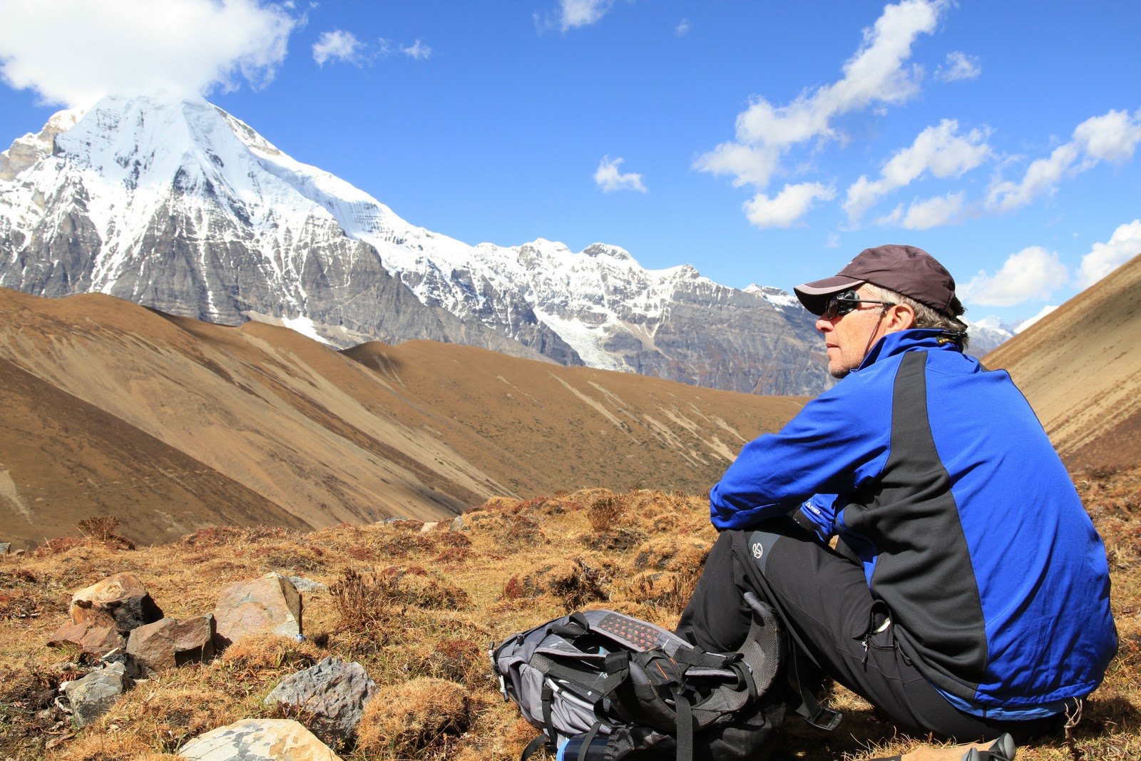
We had a very early start in order to climb a ridge above the camp in order to get better views of Jhomolhari and see the magnificent Jitchu Drake, 6989m. The ridge was steep and we followed only faint tracks on the ascent, very hard work in the cold morning air on relentlessly rising ground.
Jitchu Drake's steeple like summit soon came into view and it was to taunt us all the way up, but what a fine looking mountain. The maximum altitude we reached was 4550m, by which time the group (and me) had had enough, so after a fun photo stop, we traversed the slopes westwards and were rewarded with a close up view of Jhomolhari, beautifully lit in the morning light, showing off the many hanging glaciers that tumble down the east face - I'm not surprised it's never been climbed from the Bhutan side.
 |
| Stumpy with Jitsu Drake in the background |
 |
| Looking back to base camp from our acclimatisation walk |
 |
| Jhomolhari base camp |
 |
| Portable altitude chamber, also known as a Gamow Bag |
Time taken 3 hours, total ascent 450m, distance up and down just 2km, which shows just how steep it was!
A late breakfast and a lazy morning followed, the climax being a warm shower in a rather flimsy tent structure, the 'shower' involving a bucket of hot water and a jug to pour it over yourself! Very hot sunshine today. Felt unwell for a while this morning...probably pushed a bit too hard this morning given the altitude.
A slow lunch followed and then we were off for another acclimatisation walk at 1440, this time to reach a lake about 300m higher on the other side of the valley. Back by about 1715, and feeling quite tired now...
Day 8
We had a less noisy night, the dogs more passive tonight!
We departed Jangothang at 4100m, and followed the river until we happened upon a stone bridge at the base of the first steep climb of the day, conquered by a steady plod and distracted by close up views of Jitchu Drake's ice clad south face.
 |
| Jitsu Drake 6989m |
 |
| Climbing to Nyile La |
 |
| Jitsu Drake from the Nyile La 4890m |

 |
| A reflective Stumpy looking towards Tsheri Kang 6526m |
 |
| Yaks traversing the Nyile La |

There were many other groups on the same trail as us today, most going further east towards Laya and other regions.
We lost the view temporarily as we slowly gained altitude along a long valley, which ultimately opened up at the end to reveal a wide vista, with winding river in the bottom populated by blue sheep grazing in the near distance. Turning left we then progressed across steeper ground to reach the base of the final ascent section of the first big pass of the trek, taking some tea before we stretched our lungs once again.
On reaching the pass of Nyile La at 4890m, we were rewarded with a magnificent view of Jitsu Drake's south and east faces, Tsheri Kang 6526m, and distant views of Mount Gangcheta or Great Tiger Mountain. Awesome, this is what I'm in the Bhutan Himalaya to see.
A short steep descent on scree took us to our lunch spot, entertained by yaks making easy meat of the descent we had just come down. Then the long grind downhill starts...a relatively steep traversing track on loose scree, but manageable, before crossing the river and commencing a long high traverse towards Lingshi. A beautiful path, easily trod, and wonderful colours on both sides of the valley, with huge banks of rhododendron bushes amidst the autumnal colours of the many varieties of vegetation hugging the steep slopes. Then Lingshi Dzong appeared in the distance, standing white and resplendent in the afternoon light. And, behind us, another view of Jitchu Drake's towering east face, now catching the usual afternoon cloud build up and a close up of Tsheri Lang's south face.
 |
| Descent from Nyile La |
 |
| Lingshi Dzong |
Then a short, very steep descent before a final tramp through boggy woodland to our remote camp site in the valley bottom. No other groups with us tonight, and hopefully no barking dogs this time...
GPS distance travelled 16.7km, about 9 hours.
Day 9
A good night's sleep was had...no dogs, no horses, no yaks. A cold night though, with heavier frost on the outside of the tent this morning and greater levels of condensation inside the tent, making the down sleeping bag a little damp and therefore less effective.
An early start again as we have a high pass to cross and a very long descent afterwards. The start of the day was a long valley plod, thankfully getting into the sun after about half an hour and with good views back to Lingshi Dzong. We gained some height and then crossed a river, a bit tricky on slippery rocks. We took a rest break whilst we watched a herd of wild blue sheep below us.
Then a long haul up into a side valley, a level section, then a final steep pull up a rocky path to the top of today's pass, the Yale La, at 4950m.
 |
| Yale La 4950m |

An easy descent to a lunch spot just below the col, then a long easy descent down one hanging valley into a longer valley. Easy walking, but a long plod after a hard morning. Wonderful colours on the slopes as we reached lower elevations at around 4100m.
 |
| Superb autumn colours on the descent route from Yala La |


Then, a short climb into a new valley, and eventually reaching our camp at Walathang 4180m, above Shodu on the usual route back to Thimphu. A nice camp, high above the river, and facing attractive woodland opposite. We are now on a long detour from the normal trail back to Thimphu as a heavy monsoon this year destroyed four key bridges which have yet to be repaired.

GPS distance 18.4km, time about 8.5 hours albeit with some very long stops for slower members of the team.
Day 10
A cold morning, with heavier frost on the tents today. A peaceful night, only disturbed by a rock under my sleeping position!
A nicely located campsite with blue skies ahead bode well for the day, except for a little light cloud building up in the distance.
Another early start, heading up the valley we were camping in, and getting into the sun after 30 minutes' solid walking. The valley, of course, steepened and we could see our objective this morning, the Ledi La, a pass at 4770m (4702m on some maps), rearing up in front of us. This, naturally, proved to be a false promise, as we discovered after climbing two false summits due to the nature of the slope. Eventually, after a final steep pull, we reached the pass with extensive views all around, but no snow capped peaks to see today as the cloud base was starting to fall.

A lunch just below the col, then an initially easy slope, steepening in places, before another long valley plod and then a very steep and exposed section through a narrow rock defile brought us into our camp valley for the night. Once again, descending brought us to more vegetated slopes, juniper interspersed with yellow and red leaves on various deciduous trees. A few km before the camp, a pleasant final section of the path brought us down past yak herder encampments, through herds of docile yaks (thankfully scared of humans despite their bulk), and down to our camp right next to a river at 3990m, the lowest we've been for days. We're now at Sharidra camp.
We've seen no other groups all day: we are one of very few trekking groups to have travelled this way and it was certainly new to our leader too.
Just over 14km, 7 hours with loads of stops.
Day 11
A difficult day right from the start. I slept badly, the river no more than 5m from my tent and a leaking thermarest, so I was not too happy to see the clouds surrounding the camp site, suggesting a big change in the weather was imminent.
We set off downhill today, dropping a couple of hundred metres on an easy path down through pleasant vegetation, but the challenges of the day really started when we took a very minor track off down to the river, itself composed of loose slate, to a very narrow bridge over a raging river below.

 |
| A tricky day's walking ahead! |
Continuing onwards, we ascended higher and had a quick lunch in decreasing temperatures close to a couple of lakes.
Then a long slog in a chilly wind with light rain, through confusing country covered in rhododendrons before reaching a dramatic pass, Yeoso La, at 4444m. It was immersed in cloud, so we didn't hang around to start the very precipitous descent, a drop of some 150m in one go, albeit on a rocky but stable path.
 |
| Descent from Yeoso La |
Then a further descent on a narrow contouring path, again entering complex country covered in rhododendron bushes, passing some yaks being herded by a young lad, and then finally across boggy, rocky ground to a very remote campsite located at Rangthangdra, at 4176m.
A grey day overall, depressing weather, and difficult terrain. A testing day for all.

GPS distance 13.8km, 8 hours, total ascent 752m to end up at the same altitude!
Day 12
What a difference a day makes! The omens for today were good, blue skies appearing above the early morning cloud hugging the mountains around us at this elevation, and an all together different feel to yesterday. Having said that, it was another disturbed night, the tent pitched on undulating and sloping ground, and horses munching all night (one with a bell around it's neck) close to the tents.
We set off at 0730 again and within 90 minutes were crossing Dungtsho La, a pass at the head of the valley at approx. 4400m. The clouds were very atmospheric up here and we then descended a steep but safe trail to access a contouring path that brought us wonderful views over a number of pretty lakes in the vicinity, one of which is known as Dungtsho Cho.
 |
| The HOGs - Himalayan Old Gits - plodders all! |
 |
| Descent from Dungtsho Cho |
 |
| View to our final camp at Phajoding above Thimphu |
Our campsite, was about 150-200m below this viewpoint, and a steep track swiftly brought us down to our final camp on the trek, a nice flat setting called Phajoding at 3870m.
Phajoding sits next to a monastery, founded in the 13th century by Togden Pajo, a Tibetan yogi looking for a meditation site. Most of the buildings now date from the 18th century, and include lhakgangs/gompas, monk quarters and meditation centres.
One of the best day's walking I've had in years...
We had quite a jolly dinner for our last night camping, with music relayed from the monastery above just as we had finished eating - very atmospheric under a clear sky revealing millions of stars.
 |
| Last night in the mess tent, Phajoding |
We awoke to a hard frost and clear blue sky, with clouds filling the valleys below us. Superb. And then, just to top it all, the monks in the monastery above us started to play their horns as part of their regular daily ritual. A perfect way to start the day.

 |
| Gents of the team display beards grown during the trek! |
Our final walk involved 1000m of descent to a road head above Thimphu, a good path most of the way and the journey broken by a visit to a small teaching monastery (Jampa Lhakhang) about 100m below the camp site. We watched young monks reciting their daily prayer to Manjushri, Bodhisattva of Wisdom, delivered in classic Tibetan, and their teacher then explaining something of the Buddhist 'wheel of life' in native Bhutanese (the language is called Dzongkha). Hard work for these young lads. Unfortunately, the monastery was damaged by a recent earthquake and many members of our group were happy to leave some funds to help with repairs.
 |
| Jampa Lhakhang |
When we finally emerged at the bottom of the path, there was a small surprise awaiting us, a table festooned with soft drinks and cakes, and each of us was presented with the traditional silk scarf as we arrived. A nice gesture.
 |
| Stumpy gives thanks to the trekking crew |
Quickly down to civilisation again, and into the centrally located Hotel Pedling. A shower, a good lunch (and a couple of beers..), before a quick visit to the Textile Museum and some shopping.
At dinner we were joined by the managing director of the tour operator who had organised everything for us in Bhutan, Karma Khorko.
A good night's sleep was had, well almost...Thimphu is afflicted by large packs of dogs which roam the streets barking continuously...back to ear plugs again!
Day 14
Back to the classic tourist trail today, first visiting the National Memorial Chorten, a Tibetan style structure built in 1974 as a memorial to the third king, and a place of daily worship for many of Thimphu's older citizens. Many were circumnavigating the stupa with prayer wheels and beads, and a few prostrating too. Some aged folks spend time rotating large prayer wheels at the entrance. Monks were seen chanting prayers for someone recently deceased in a nearby temple. Very atmospheric indeed.
 |
| National Memorial Chorten, Thimphu |


Next we paid a quick visit to the Motithang Takin Reserve, a small zoo housing Bhutan's national animal, the takin, a cross somewhat akin to a gnu and a bison. Small red barking deer were also seen. A couple of weavers had set up stools nearby, and a purchase of cotton and raw silk scarves made.
 |
| A young takin, Bhutan's national animal |
 |
| Trashi Chhoe Dzong, Thimphu |
 |
| Students studying sculpture at the National Institute of Zorig Chusum |
Our final visit was to the National Library, established in 1974 to preserve ancient Dzongkha and Tibetan texts. Sited in a beautiful building, it is also home to the world's largest book, a pictorial study of Bhutan. Some fine old historical photos also adorn the walls.
 |
| National Library, Thimphu |
 |
| Paro at Royal Wedding time |
 |
| Starting them young on Dharma! |
 |
| Downtown Paro! |

Day 15
An early start, leaving the hotel at 0630 to start our ascent to the Tiger's Nest Monastery, properly known as Taktshang Goemba, built in 1692 around the holy cave in which Guru Rinpoche is said to have meditated.
Our hotel was only 20 minutes from the start of the trail, and we were the first off up the hill today, climbing steadily through the pine forest on a track that is well worn but would be horrible in the wet. Pleasant walking in the cool morning air, passing water driven prayer wheels and numerous chortens and prayer flags on the climb.
 |
| Approaching the Tiger's Nest Monastery |
 |
| Taktshang Goemba |
 |
| One of Bhutan's most iconic sites, the Tiger's Nest Monastery |
And early lunch at a restaurant called Nivvana in the upper Paro valley, and then, after a freshen up, into Paro to join the locals in the last hours of the celebrations for the royal wedding. Once again, everyone on the streets enjoying a day off, colourfully garbed in national costumes.
Day 16
Fly from Paro to Kathmandu.
Efficient little airport with friendly staff.
Lunch with some friends from Exodus and their Nepalese operators, Karma and Pasang, before an indulgent hour or so in my favourite bookshop in the world, Pilgrim's Book House in Thamel.
Final group dinner at the Garden of Dreams...competently cooked western food and some wine for the first time on the trip. Farewells to many of the group...a nice bunch of people to have travelled with.
Day 17
Leaving behind the usual chaos of Kathmandu airport, we flew to Delhi (100 minutes, on schedule) and then on to London.
 |
| HOGs hard at work! |
 |
| Happy Exodus group celebrate getting to the top of the Yale La! |
© Colin Stump, October 2011
1 comment:
THANKS U ,
The Bhutanese prayer flags have been a part of the Bhutanese culture since many centuries. They are a crucial part of the people’s traditions here. The flags in Bhutan symbolize long life, prosperity, happiness and luck to all individuals. There is a belief in Bhutan according to which when an individual dies, the advantages of offering prayer flags are said to guide to soul of the dead away and prevent it from having a rebirth in the 3 lower realms namely; Nge Song Sum, animals, pret and life in hell) of the six life cycles: Lha (god), Lha Min (demi God), humans, animals, pret, and life in hell. There are normally three kinds of printed prayer flags: Lungdhar or Chudhar, Lhadhar and Mani or Baza Guru dhar which are engraved with positive signs, invocations and prayers.
Post a Comment