10 September 2005

Tour of the Oisans (GR54 in the Ecrins)

Trip undertaken 28 August to 3 September 2005


Travelling companions: Richard Pratt and Hayden Measham. Self guided and accessed via Grenoble.


Guide books: Tour of the Oisans by Andrew Harper, and The Ecrins National Park by Kev Reynolds (both Cicerone Press).


Day 1


Left the Hotel Oberland in Bourg d’Oisans at 0830. Adequate hotel with friendly staff and very focused on road biking clientele. Bought food in the town centre and headed across the valley to start the ascent of the GR54 path, leading steeply north in the direction of Huez. Passing the side of la Cascade campsite we were soon ‘enjoying’ slippery rocks and chains to assist on the steeper sections. Then we managed to miss a right hand turn on the path and had an epic on a steep muddy woodland track on the east side of the Cascade de Sarenne. Very unpleasant. Moral of the story is: keep your eyes peeled for the GR red and white markers and if you find yourself on unstable, overgrown and increasingly scary terrain, you’re probably not on a GR path! So we backtracked and after 15 minutes relocated ourselves on to the right path. Rocky scrambles leading to a pleasant woodland path took us to la Ville, then easy forest paths to Maronne and le Rosay before a steep descent to the Sarenne valley, picking up the easy main trail out of Huez.
We climbed up into the narrowing valley with a quick refreshment break at the Gite d’Etape above Combe Haut, followed by a long plod past the Cabanes de Sarenne and Col de Sarenne (1999m), arriving at 1400.
Lunch stop here with big views down into the Ferrand valley and the village of Clarans le Haut, some 600m below our feet. It was a lofty perch for lunch.


View from Col de Sarenne 1999m
A good path takes you swiftly down to Clarans le Haut (one hour) and then there was easy walking down the valley to the very attractive village of Clarans le Bas.
A short descent took us to a river crossing across a footbridge, before the final steep pull up a shaly ridge to Besse at 1530m, our final destination, arriving about 1700. Super little village with nice hotel, Hotel Alpin, with friendly young hosts. Good crepes and Kronenbourg rounded off the day!


Hotel Alpin, Besse
Day 2


Start of day 2
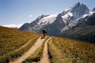
The day dawned clear with bright blue skies. Had a decent breakfast and got going about 0845, taking the valley north east of Besse on a broad easy track for about 1.5 Kms. Then steep contouring path took us to Col Nazie (1902m) with great views N.E. to Pic du Lac Blanc 3323m and the Glacier de Sarenne immediately to the south of it. Then a very sustained zigzag ascent to Col Bichet at 2245m, reaching the top by about 1045 (two hours from start). A 15 minute break in a fresh easterly wind revived us and we then had an easy moorland crossing and slow plod up to Col de Souchet at 2362m, gaining fine views of the northern aspects of the Ecrins, with superb views of the 3982m high la Meije and the steep Glacier de la Girose falling into the heavily wooded Valle de la Romanche.


Ascent to Col Bichet
Moorland crossing to Col Souchet
This was followed by a great ‘balcon’ walk from the col, leading us across the Plateau d’Emparis and the slowly descending to a fine viewpoint above le Chazelet where we had a leisurely lunch out of the wind.


Northern edge of the Ecrins
Towards la Meije 
Path down to le Chazelet
GR54 to le Chazelet
The early afternoon was dominated by a long zigzag descent of about 400m to the beautifully situated le Chazelet (mainly new ski chalets though), then down the road to les Terrasses before a final, weary descent across the meadows to la Grave where we checked in to the Auberge Edelweiss.


Valle de la Romanche
la Grave, Ecrins National Park
Nice beer garden overlooking la Meije. The hotel, run by Dutch lady Marlon and partner Robin Gray (who used to be associated with adventure holiday company Exodus), mainly caters for extreme skiers and the mountain biking fraternity. Hayden invested in new boots, having suffered with his old pair and having resorted to walking in sandals for much of the walk so far (not recommended!).


Day 3


A long day ahead! We left the village after buying some pizza for lunch, getting on our way by 0850. Dropped down to the river, then followed a contouring path through the woods before going more steeply up through the woods to cross the ridge high above the valley, climbing to 1756m on a very quiet path.


Ecrins National Park
We crossed into the Ecrins National Park (which means that the GR red and white waymarks become almost non-existent) and crossed the river again at Pont de Brebis after about 2 hours. Encountering our first tourists for over two days we then walked up a wide valley, before pulling steeply away from the crowds (well, OK, about 10 other walkers), climbing up a rock band on zigzags and surrounded by huge waterfalls in all directions in an area known as ‘Les Voutes’. This was followed by an interminable plod in very hot sunshine, passing the Refuge de l’Alpe de Villar d’Arene (2077m), and eventually reaching the Col d’Arsine (2340m) where we had a well-deserved lunch break.


Zigzags en route to Col d'Arsine
Refuge de l’Alpe de Villar d’Arene (2077m)
Then, moving east, we passed aquamarine blue glacial lakes, before a long series of zigzags down unstable ground brought us to Lac de la Douche. Knees needed a rest here! Then a final drop through the woods on a broad path to le Casset, where the knackered team resorted to Coke and ice cream before the final level valley walk to our destination of the day, the Auberge Choucas in Monêtier les Bains (also known to skiers as Serre Chevalier 1500). A very comfortable hotel, rather more upmarket than we really needed, but lovely all the same, with fine dining and some indulgent wine choices which raised a few eyebrows when we settled the account the following morning! Outstanding cheese. Bed by 2130!


Glacial lakes below Col d'Arsine
View back on day 3 from le Casset
Day 4


We had a slow start as the hotel breakfast only available form 0800…very late for the walking fraternity! Finally got going at 0850, walking across the wrong bridge (Hayden had the map though!!) and crossing over pastureland before climbing up steeply rising woodland tracks for three hours to reach the Col de l’ Eychauda (the last 45 minutes on unpleasant gravel ski lift service roads). An unattractive col, though with big views to the east and west in very hot and dry conditions. 


View from descent after Col de l'Eychauda
We took a traversing path due south, then a long series of zigzags lost us 600m before lunch at 1300 looking down the Vallee de Chambran at ~1900m. Stopped a little later for more ice cream at Chambran before a valley plod in increasing heat, before turning N.W. into the valley leading to Ailefroide. Then came the surprise. Looked simple on the map…but reality on the ground was somewhat different. A nasty little path, with many ups and downs, crossing unstable scree slopes and ravines, plus largely overgrown with spiky plants. Nice! One hour 10 minutes to Ailefroide said the sign. Don’t believe a word of it! One hour 40 minutes later, duly humbled, we arrived in Ailefroide, crossed the glacial torrent and reached our hotel for the night, the Hotel Engilberge. 


Horrible little path to Ailefroide
A fabulous setting though, with towering rock walls, up to 2000m above us, all around. Enjoyed much needed beer and reflected on a walk that started 8 hours earlier.


Day 5


Started at 0830 with the simple objective of climbing up to the Refuge Cezanne, now known as the Refuge de la Pre de Madame Carle, at 1874m. A very easy walk, some on the road but mostly on a rough, overgrown track. After a coffee we set off for the Refuge Glacier Blanc (can’t keep a good team down!) and zoomed up easy zigzag paths to 2380m where we decided we wouldn’t have time to get to the refuge, have lunch and get down in time for a taxi already booked to get us down the valley to our penultimate overnight stop at Vallouise. So, we had a quick stop on the smooth, striated granite blocks overlooking the snout of the fine Glacier Blanc and in sight of the refuge 250m above.


Glacier Blanc
Barre des Ecrins above Glacier Neige
Glacier Blanc
We left our perch at 1115 and reached the valley bottom 400m below just over one hour later, with fine views up to Glacier Neige and the Barre des Ecrins 4102m to the west and Mont Pelvoux 3943m immediately above us to the south. Omelettes and local (Briançon) brewed beer at Refuge de la Pre de Madame Carle, then a 1 ¼ hour yomp back down the valley to Ailefroide. Great scenery here, with marmots and chamois seen below the huge rock walls and cascaded on either side of the valley.
Taxi down to Vallouise where we checked into the Hotel le Vallois. Pleasant enough village with a brew pub and some unusual chalet architecture, with many levels (hay lofts) and use of stone arches on the lower elevations (but we’re now only 50Kms from Italy).


Day 6


Now out of season, so forced to take an early taxi to Briançon and managed to check in to the hospitable Hotel Edelweiss, just below the historic old fortified town.
Impressive town, worth a visit, a decent lunch at a restaurant overlooking the valley to the north of the town and all was well with the world!


Briançon
Summary


A more challenging route than the Tour du Mont Blanc, with some long days and, to the north, more shaly slippery paths than were expected.
We only did the opening sections of the GR54 and it gets more challenging later in the route, with some very long, isolated days with mountain refuges the only overnight options. But we’ll be back…the area is unspoilt, virtually undiscovered by the wider walking community (most Brits going to the Ecrins will be going to rock climb), and spectacular.